Burzil Pass: The oldest-known route.
Historical Significance:
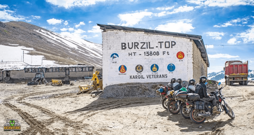
Burzil Pass is a high mountain pass in Astore Valley, located in the Gilgit-Baltistan territory of Pakistan, at an elevation of 4.210m (13,812ft) above sea level. It is part of the historic route, followed by caravans between Srinagar and Gilgit. It is the way to access Srinagar (Indian occupied Kashmir) and Gilgit, Pakistan. It is believed that historically, travelers used to cross the pass for traveling by horses and ponies between Srinagar and Gilgit.
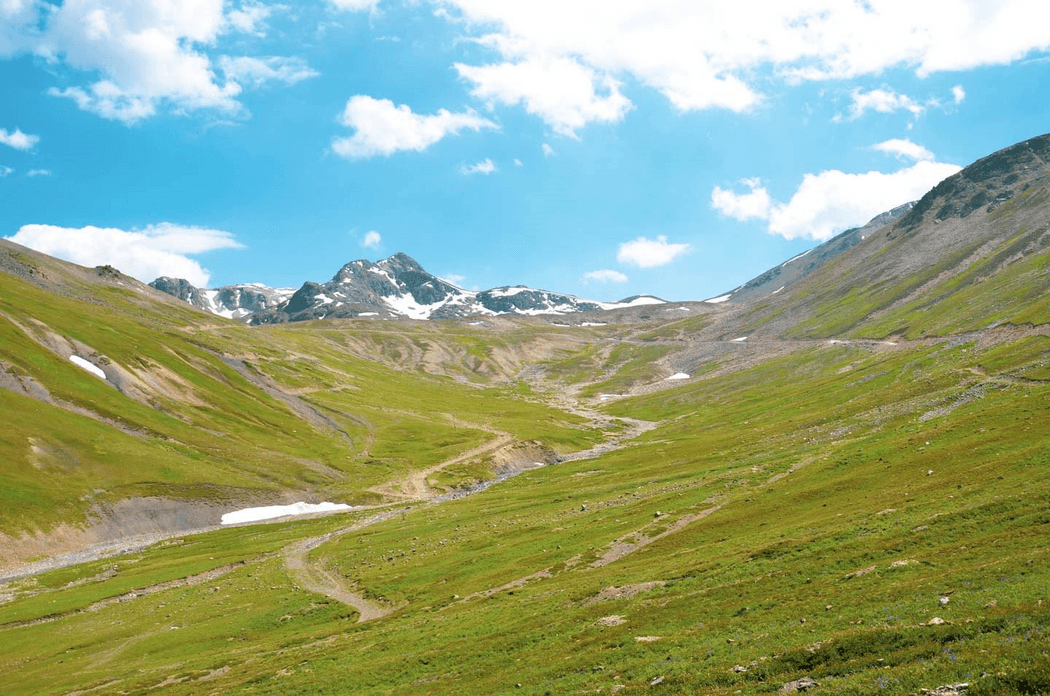
Burzil Pass is a stunning natural attraction. It features grassy slopes covered in bright flowers and alpine plants, with breathtaking views. The mix of blooming flowers, flowing streams, and snow makes it a must-visit spot in Gilgit-Baltistan.
Geographical Significance:
Burzil Pass is about 5 kilometers north of the boundary between Pakistan-administered Gilgit-Baltistan, Azad Jammu, and Kashmir. It is also roughly 30 kilometers north of the Line of Control (LoC), which separates Pakistan and India in the disputed Kashmir region.
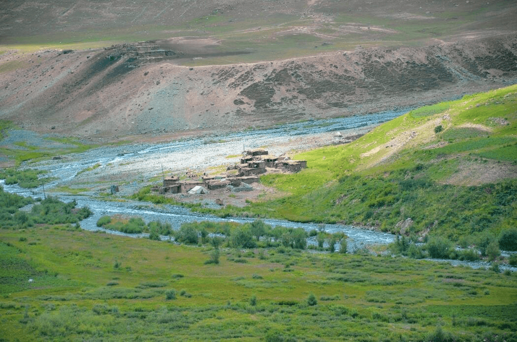
The Astor River, a tributary of the Indus River, flows from the western slopes of the pass. It runs through Astore Valley, draining the Deosai Plateau.
Access to Burzil Pass:
Burzil Pass is the oldest route linking Gilgit to Skardu via the Deosai plains. It is about 5 km north of the boundary between Gilgit-Baltistan and Pakistan-occupied Kashmir. You can also reach Burzil Pass from Astore. This route goes through Gorikot, Maikaal, Dad Khitran, and Chilum Choki before reaching the Deosai plateau. The road leading to the pass is called Astore Valley Road.
Additionally, Burzil Pass can be accessed from Minimarg Valley. This connects to the route between Kashmir and China. The road from Minimarg features a steep slope with stunning views that lead to Burzil Pass.
Dining:
Burzil Pass has small kiosks near scattered local huts. You can grab locally made snacks or chat with locals to experience the hospitality of the Pakistani people.
Climate of Burzil Pass:
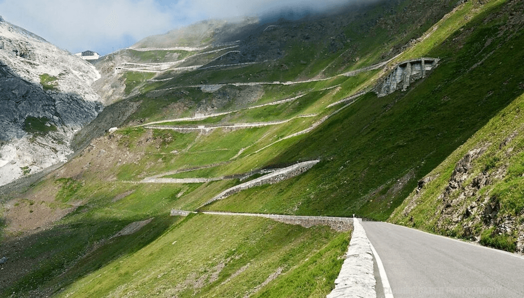
The climate on Burzil Pass is harsh, with unpredictable weather patterns. The weather can change in a short period. One moment, the sun fills the sky with brightness, and the next, clouds gather. Rain changes without warning into moderate to heavy snowfall. The best time to enjoy the scenic beauty of Burzil Pass is from May to July.
So do not miss out; Burzil Pass is a place to visit. Plan your trip by clicking the following button and completing the form.